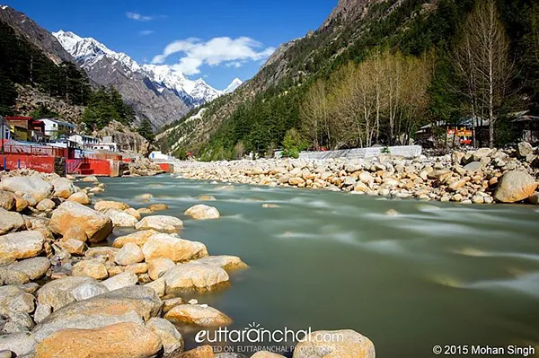
The Bhagirathi River is a Himalayan River which flows in Uttarakhand state. It is one of the two headstreams of the pious Ganga River. This river has a length of 205 km and basin about 6,921 sq km. According to Hindu mythology, it is believed that Bhagirathi River is the source-stream of Ganga River.
Whereas, hydrology report states Alaknanda, the other headstream as the source stream, because of its great length and discharge.The headwaters of Bhagirathi River are formed at Gaumukh, perched at an elevation of 3,892 metres about 12,769 feet above sea level, at the foot of Gangotri glacier and Khatling glaciers in the Garhwal Himalaya.
It is then joined by its various tributaries, Kedar Ganga at Gangotri, Jadh Ganga at Bhaironghati, Kakora Gad and Jalandhari Gad near Harsil, Siyan Gad near Jhala, Asi Ganga near Uttarkashi and Bhilangna River nearOld Tehri.
Bhilangna, which is the major tributary of Bhagirathi River, rises at the foot of the Khatling Glacier, perched at an elevation of 3,717 metres about 12,195 feet above sea level. It is approximately 50 km south of Gaumukh. The Bhilangna river flows about 205 km from its source, before meeting Alaknanda River at an elevation of 475 metre about 1,558 feet above sea level, in the town of Devprayag. The downstream of this confluence is considered pious by the Hindus. The highest point of the Bhagirathi basin is Chaukhamba I.
The famous Tehri Dam lies at the confluence of Bhagirathi and Bhilangna River near Tehri Garhwal.The operational hydroelectric dams on Bhagirathi River are Maneri Damn, Joshiyara (Bhali) Dam, Koteshwar Dam and Tehri Dam. Other than this Loharinag Pala Dam, Pala Maneri I Dam, Kotli Bel 1A Dam, Kotli Bel 1B Dam, Kotli Bel II Dam are being constructed. Also, few dams have been planned such as Karmoli Dam, Gangotri Dam, Jadhganga Dam, Bhaironghati Dam I, Bhaironghati II Dam, Harsil Dam, Bhilangana II Dam and Bhilangana I Dam.