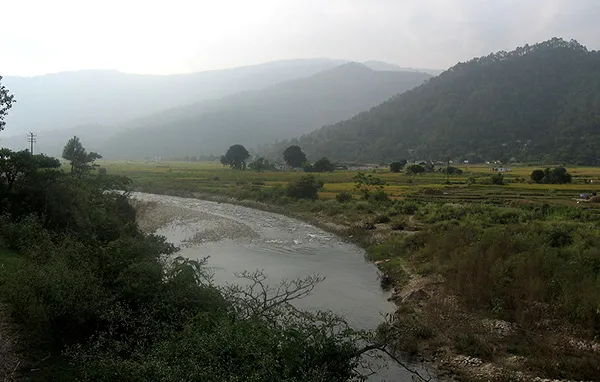
Ramganga West River emerges from Dudhatoli ranges in Pauri Garhwal district of Uttarakhand. The length of Ramganga River is 155 km and the catchment area of the basin is 30,641km square. This river flows to the southwest from Kumaun Himalayas. Ramganga is a tributary of Ganga, which originates from the high-altitude zone of 800m to 900 m.
It passes through Corbett National Park, near Ramnagar in Nainital district and descends to the plains. The cities alongside the banks of Ramganga River are Moradabad, Bareilly, Badaun, Shahjahanpur and Hardoi of Uttar Pradesh state.The Ramganga Dam also known as Kalagarh Dam, 3 km upstream of Kalagrah River in Pauri Garhwal, is an embankment dam set up on Ramganga River.
This dam is a part of the Ramganga Multipurpose Project, which is an irrigation and hydroelectric project. After meeting Kalagarh, Ramganga flows in the southeast direction and finally joins Ganga on its left bank, near Kanauj in Fatehgarh district.The entire river flows in Uttarakhand and Uttar Pradesh states.
The important tributaries of Ramganga are Kho, Gangan, Aril, Kosi and Deoha also known as Gorra. Ramganga flows through various places and consolidates many places into one. It passes through Taal, Chaukhutia, Bhagoti, Masi, Bhikyasen etc. which comes under Kumaon region.