For every state, region or country, roads play a vital role in their economy and development. Uttarakhand being a hill state is relatively less developed than plain areas. The maintenance charge of Hilly roads is very high and they often get damaged in harsh weather or due to natural calamity like landslides.
After Independence, the process of making roads in Uttarakhand was very slow but, the 1962 war of Indo-China gave a much-needed boost to the construction of roads, all over the Uttarakhand because it share a wide range of border with china. Today, Uttarakhand proudly exhibits 14 National Highways, having a length of 2108 kilometres. Below is the list of all National highways with their route.
List of National Highways in Uttarakhand
NH 125
Route: Junction with NH-74 near Sitarganj and connecting Khatima – Tanakpur and terminating at Pithoragarh.
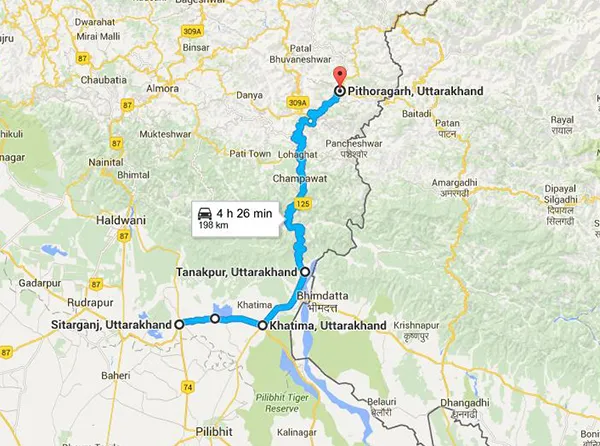
Google Map : National Highway 125
NH 123
Route: Junction with NH-72 connecting Vikasnagar - Kalsi - Barkot and terminating at junction with NH 94 near Barkot bend.
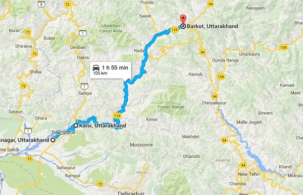
Google Map: National Highway 123
NH 121
Route: Junction with NH-74 near Kashipur connecting Ramnagar – Dhumakot – Thalisain - Tripalisain and terminating at NH 119 near Bubakhal.
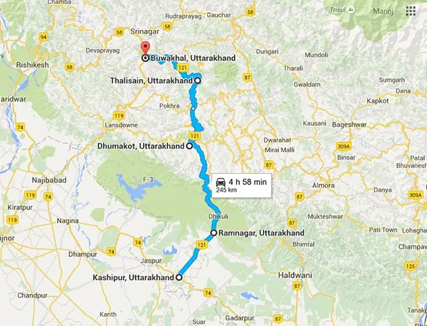
Google Map: National Highway 121[/caption]
NH 119
Route: Junction with NH-58 near Meerut and connecting Bijnor - Najibabad - Kotdwara - Pauri and terminating at its junction with NH-58 near Srinagar at Takoli Challannsyun, Uttarakhand.
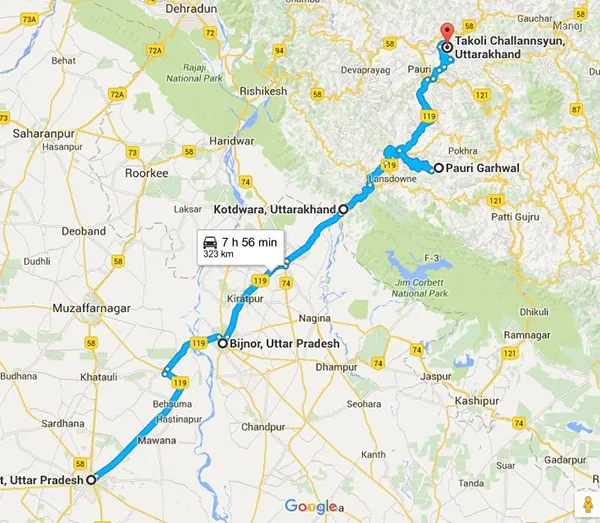
Google Map: National Highway 119
NH 109
Route: Rudraprayag - Guptkashi - GauriKund near Kedarnath
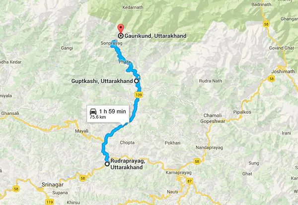
Google Map: National Highway 109
NH 108
Route: Dharasu - Uttarkashi - Harsil - Gangotri Dham
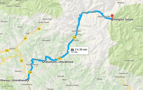
Google Map: National Highway 108
NH 94
Route: Rishikesh - Chamba - Tehri - Dharasu - Barkot - Yamunotri
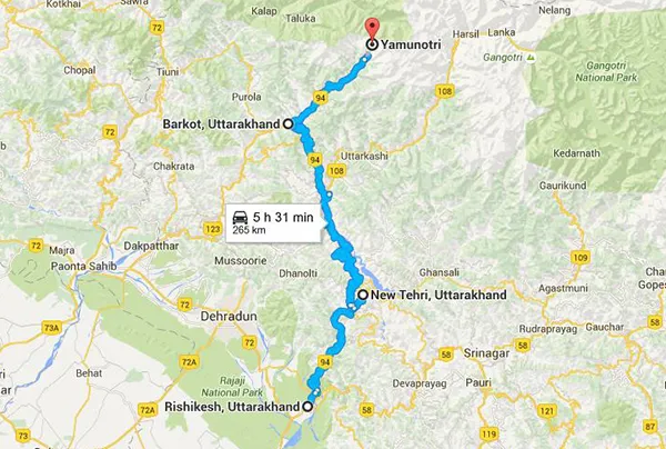
Google Map: National Highway 94
NH 87
Route: Rampur - Pantnagar - Haldwani - Nainital - Bhowali - Almora - Ranikhet - Dwarahat - Chaukutia - Gairsain - Adi Badri and terminating at its junction with NH 58 near Karnaprayag
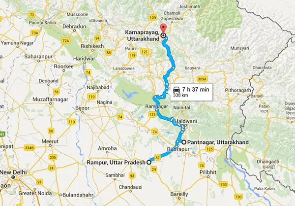
Google Map.
NH 74
Route: Haridwar - Nazibabad - Kashipur - Kiccha - Bareli
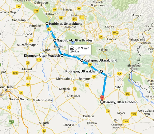
Google Map: National Highway 74[/caption] NH 73
Route: Roorkee - Saharanpur - Yamunanagar - Panchkula
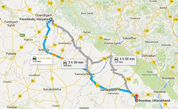 Google Map: National Highway 73
NH 72B
Route: The highway starting from Paonta at the junction of NH-72 connecting Rajban, Shillai and passing through Minus, Tuini in Uttrakhand and terminating at Hatkoti in Himachal Pradesh.
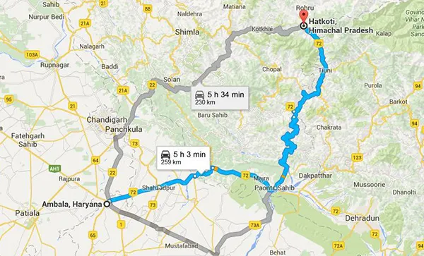
Google Map: National Highway 72B
NH 72A
Route: Chhutmalpur - Biharigarh - Dehradun
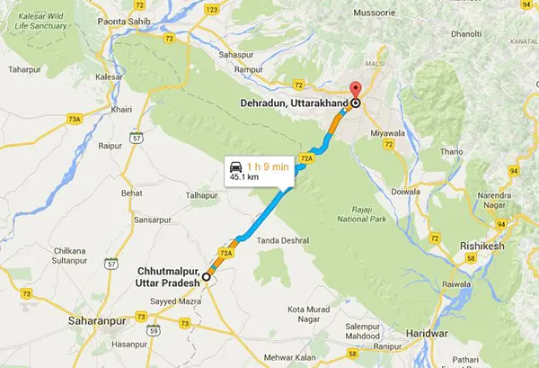
Google Map: National Highway 72A
NH 72
Route: Ambala - Nahan - Dehradun- Rishikesh
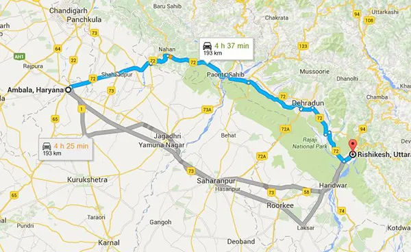
Src:- Google Map: National Highway 72
NH 58
Route: Ghaziabad - Meerut - Haridwar - Rishikesh - Badrinath - Mana village
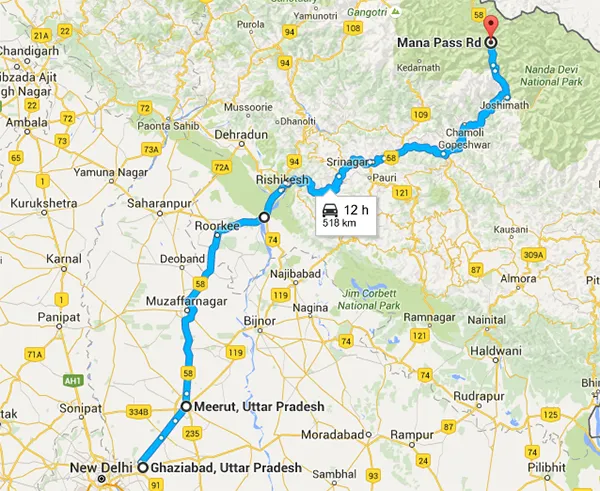
Src:- Google Map: National Highway 58
Note: There are some changes in National Highway Names and routes, some National Highways has also be converted to State Highways. We will update the same later.