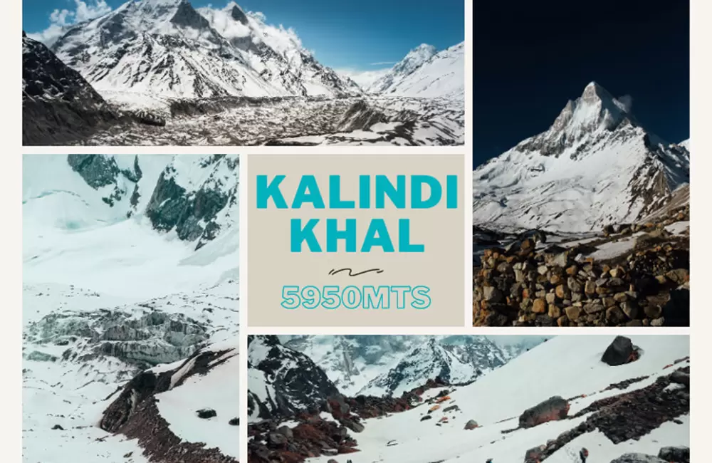
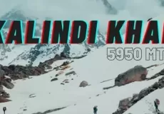
About Kalindi Khal Trek
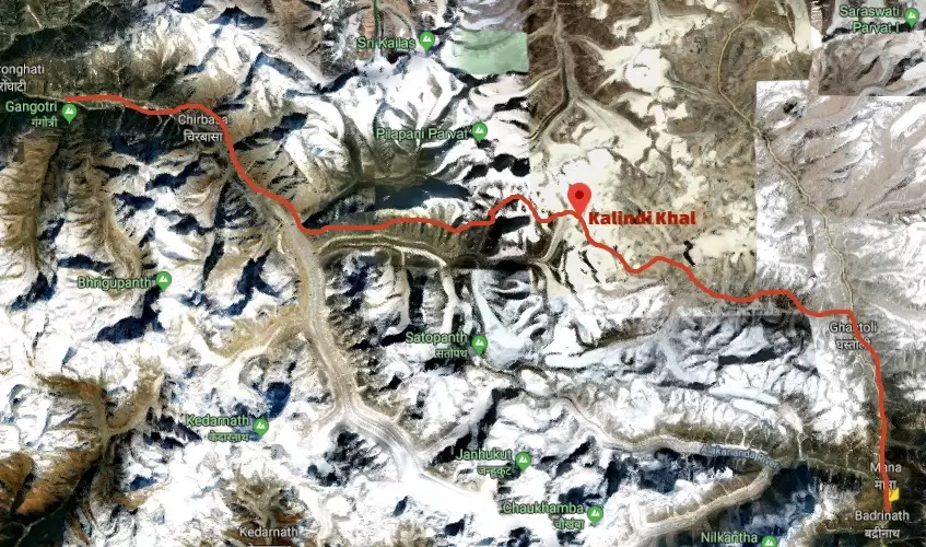
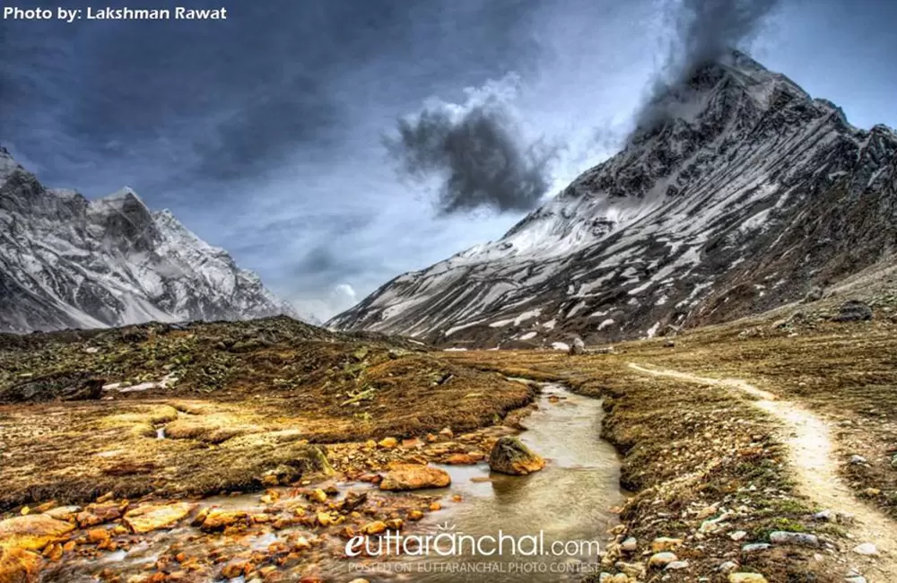
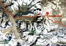
The trek starts from the town of Gangotri and passes through an adventurous trail taking you through captivating meadows, high altitude natural lakes like Vasuki Tal and Arwa Tal, rugged glaciers, snowfields, and rocky terrains. Trekking equipment like rope, ice axes, and crampons will come handy in KalindiKhal Pass trek.
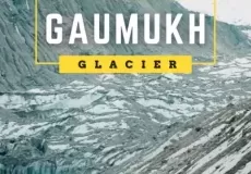
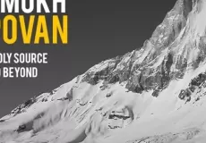
The journey starting from the Bhagirathi Valley (Gangotri) takes you to Gaumukh, the mouth of Gangotri Glacier from where River Ganga originates. From Gaumukh, you’ll ascent to Tapovan and Nandanvan through glacial crevasses.
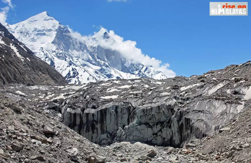
You’ll get to see the mesmerizing views of the Bhagirathi group of peaks and the Shivling peak from here. You’ll move forward to Vasuki Tal (origin of Vasuki Ganga) by crossing narrow ridges and an ice wall. You’ll cross through Suralya Bamak and Sweta glacier to reach KalindiKhal Pass, the base of Kalindi peak. After climbing Kalindi Summit, you’ll start your downward journey to Arwa Tal and Mana Village.
The strenuous journey is marked by awe-inspiring views and adrenaline-filled experience. Keep in mind that the trek is recommended for people familiar with mountaineering and not suitable for beginners.
Cost of Kalindi Khal Trekking Expedition
15 Days budget trek of Kalindi Khal is approx: Rs 99000 + 5% GST
Deluxe trek of Kalidin Khal Pass: Rs 130000 + 5% GST
*Note: The price this trek is tentative only and may vary due to season, services required and number of persons. Buffer days will be charged on pro-rata basis. Cost will be higher for Foreign trekkers.
Best Time for Kalindi Khal Trekking Expedition
The best time for Kalindi Khal Pass trek is between the summer and monsoon months from mid-June to early-September.
- Summers: The weather remains extremely pleasant during summers with clear blue skies, distinct views of the Himalayan peaks, and soothing cool breeze.
- Monsoons: The entire forests, meadows, and valleys come to live during monsoons. The wild-flowers, the lush green grasses and leaves, and the entire route look surreal and magical. The weather remains pleasant during this time.
Kalindi Khal Expedition (Gangotri to Badrinath Trek) Suggested Trekking Itinerary
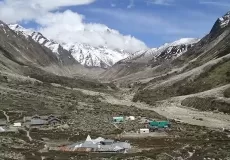
Day 01: Delhi – Gangotri (Highest altitude: 3100 mts, Distance 495 km/13 hrs)
Start your journey towards Gangotri early in the morning as Delhi from Gangotri covers a distance of about 500 kms and will take about 13 hrs to cover. Upon arriving early, you can enjoy roaming around the scenic Gangotri town while admiring the holy River Ganges flowing peacefully alongside it. You will be briefed about your trek, have your dinner, and sleep overnight at Gangotri hotels.
Tip: 1 day can be used for acclimatization in Gangotri.
Day 02: Gangotri – Chirbasa – Bhojwasa (Highest altitude: 3792 mts, Trek: 14 km/5-6 hrs)
You’ll start your trek to Bhojwasa after an early breakfast at Gangotri. The entire trail towards Bhojwasa goes through thick alpine forests and crosses the tree line of Chirbasa. After Chirbasa, the land is barren till Bhojwasa. All the while, River Bhagirathi accompanies you and as you progress further you get to see the beautiful sight of the Bhagirathi group of peaks.
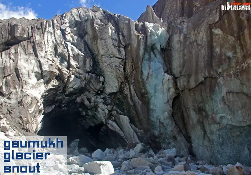
Day 03: Bhojwasa – Gaumukh – Tapovan (Highest altitude: 4463 mts, Trek: 13 km/4 hrs)
The trek from Bhojwasa to Gaumukh goes through pine and birch forests and rocky terrains. Gaumukh is the mouth of the Gangotri Glacier and the spot from where River Ganga flows down from the glacier. After a steep climb from Gaumukh, you’ll reach Tapovan. A high-altitude meadow set at an elevation of 4,463 m, Tapovan is a blessing for trekkers. Encompassed with wildflowers, pleasant streams, and herds of blue mountain goats (bharals), with the snow-clad mountains towering in the backdrop, Tapovan is a lovely campsite to explore and rest.
Day 04: Tapovan – Nandanvan (Highest altitude: 4500 mts, Trek: 8 km/4-5 hrs)
The route from Tapovan to Nandanvan goes through the rocky ridges, crevasses, icy sheets, steep vertical ascents, calming streams, and beautiful lush green colourful valley. The 3 km long and 1.5 km wide Nandanvan grasslands provide one of the best views of the majestic Shivling, Bhagirathi, Sudarshan, and Thelu peaks.
Day 05: Nandanvan – Vasuki Tal (Highest altitude: 4880 mts, Trek: 6 km/4 hrs)
On your way to Vasuki Tal, you will cross the Chaturanga Glacier and come across beautiful views of Meru and Bhrigupanth. Vasuki Tal is a small half-frozen lying at the base of Mt.Satopanth and Mt.Vasuki Parbat.
Day 06: Vasuki Tal – KharaPathar/Suralya Bamak (Highest altitude: 5480 mts, Trek: 6 km/4 hrs)
The trail to Khara Patthar is filled with moraines and thick snow beds. Khara Pathar/Suralya Bamak too is encircled with moraines and you will camp amongst them.
Day 07: Khara Pathar – Sweta Glacier (Highest altitude: 5500 mts, Trek: 4 km/4-5 hrs)
Despite being a short distance trek, the altitude makes the walk quite tough. After covering steep moraine tracks, you’ll reach Sweta Glacier, seated restfully amidst windy mountains and surrounded by the lofty peaks of Gangotri group, Bhagirathi group, and Shivling.
Day 08: Sweta Glacier – KhalindiKhal Base Camp (Highest altitude: 5600 mts)
A gradual climb through mountains and glaciers will take you to KalindiKhal Base Camp.
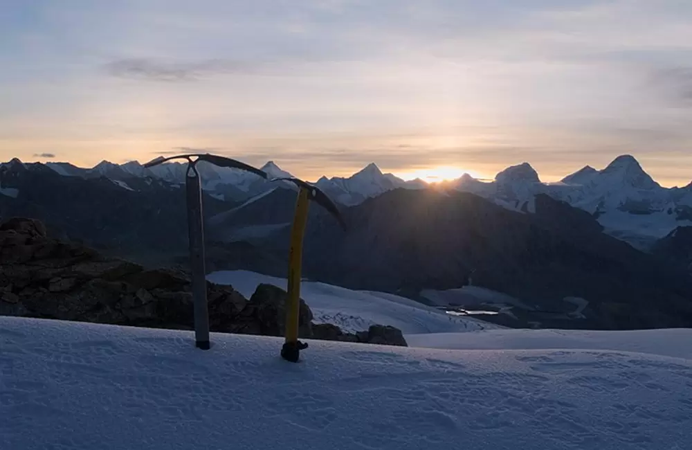
Day 09: KalindiKhal Base Camp – KalindiKhal Pass – Raja Parav (Highest altitude: 5940 mts, Trek: 13 kms)
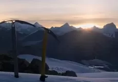
The demanding trek towards KalindiKhal Pass starts early in the morning at about 1-2 am and goes through a very challenging trail filled with snow, hidden crevasses, ascents, and descents. However, the grandiosity of the pass makes every drop of sweat and maybe even tears, worth it. The imposing views of the spectacular peaks right in front of you and the vastness of the entire area, will certainly make you gape in wonder. After enjoying the beauty of KalindiKhal Pass, you will begin your descent to Raja Parav which is set at an elevation of 4910 mts, and camp there.
Day 10: Raja Parav – Arwatal (Highest altitude: 4910 mts, Trek: 14 km/6-7 hrs)
The downhill to Arwatal goes through glacial terrains and it is recommended that you start the trek early in the morning before the glacial water level rises. Arwatal is a beautiful camping location beside a lake, set at an elevation of 3,910 mts.
Day 11: Arwa Tal – Ghastoli (Highest altitude: 3910 mts, Trek: 16 km/5-6 hrs)
Ghastoli is a serene meadow at an elevation of 3,796 m, serving as the Indo-China border.As it is a military outpost, ITBP camps are set up here. Having seen only grays for so long, seeing the lush green valleys of Ghastoli provides a sense of fulfilment. You will spend your evening enjoying the peaceful scenery and camp at Ghastoli.
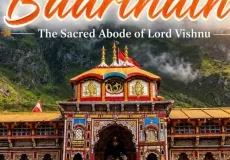
Day 12: Ghastoli – Mana Village – Badrinath (Trek: 18 kms, Drive: 3 kms)
After a heartfelt breakfast, you will start your trek to Mana Village- the last Indian Village in Indo-China border. A 7 hrs easy walk of 18 km will take you to Mana Village. 3 km from Mana Village lies the holy town of Badrinath (3096 mts). You will drive to Badrinath, visit Badrinath Temple, and stay overnight in Badrinath hotels.
Day 13& 14: Badrinath – Joshimath – Rishikesh – Delhi
The drive from Badrinath to Delhi will be convenient if you halt at Rishikesh. You can start the journey from Rishikesh to Delhi on the next day.
Note: 14 Days are minimum for this trekking expedition from Gangotri-Badrinath. It will require some buffer days (in case of bad weather) and acclimatization days in case the group needs it.
Kalindi Khal is also know as Kalandani Khal, Kalandani Khal Pass, Kalandani Trek, Kalindi Trek, Gangotri to Badrinath Trek
What is Kalindi Khal Trek famous for?
Kalindi Khal Trek is famous among tourist as Trekking, Expedition, High Altitude Trek, Camping, Garhwal Trekking, High Altitude Pass.
Kalindi Khal Trek is recommended destination for Foreigners, Groups.
Kalindi Khal Trek is popular destination for following activities/ interests - Adventure, Camping, High Altitude Mountain Pass, Trekking.