21 Treks Around Char Dhams for Adventure Lovers
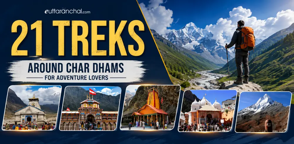
Char Dham Yatra is one of the most exhilarating and fulfilling pilgrimage treks of India. The Char Dhams, namely, Yamunotri, Gangotri, Kedarnath, and Badrinath hold a special significance not just for religious and spiritual people but for adventure seekers too.
Keeping the importance of Char Dhams in mind, we have compiled a list of treks that you can undertake around the four pilgrimage sites of the Char Dhams so that you get the best of not just the Char Dhams but its neighboring scenic spots.
List of Treks near Char Dhams - Badrinath, Kedarnath, Gangotri and Yamunotri
Treks around Kedarnath
Treks Around Kedarnath — Difficulty & Duration
| Treks | Difficulty | Approx Duration | Best Time |
|---|---|---|---|
| Vasuki Tal | Moderate | 1–2 Days | Jun–Sep |
| Painya Tal | Difficult | 2–3 Days | Jun–Sep |
| Gandhi Sarovar (Chorabari Tal) | Easy to Moderate | 1 Day | May–Oct |
| Panwali Kantha | Moderate | 4–5 Days | May–Jun, Sep–Oct |
1. Vasuki Tal
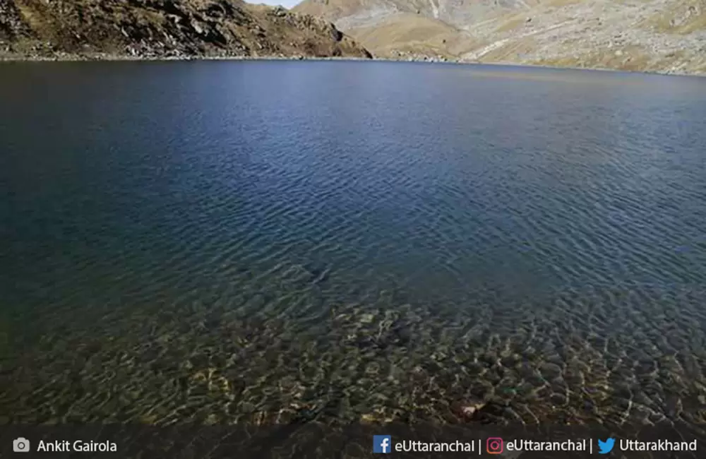
Trekking route: Gaurikund – Rambara – Garud Chatti – Kedarnath – Vasuki Tal
Vasuki Tal is a serene high-altitude glacial lake located above Kedarnath, known for its crystal-clear waters and stunning Himalayan backdrop. Vasuki Tal is one of the most scenic treks in the region, offering beautiful views of Brahma Kapal and other sacred Himalayan landscapes.
- Distance: Around 8 km from Kedarnath (approx. 24 km from Gaurikund via Kedarnath route)
- Elevation: ~4,135 meters
- Difficulty Level: Moderate to Difficult (steep ascent with rocky mountain trails)
- Time Required: 1 full day from Kedarnath (5–7 hours round trip)
- Elevation Gain: Significant climb from Kedarnath, making it physically demanding
The trek offers breathtaking views of snow-clad peaks, including Chaukhamba range, along with alpine meadows and rare Himalayan flora. Trekkers pass through rugged terrain and high-altitude sections, making it a rewarding yet challenging experience for adventure seekers.
2. Painya Tal
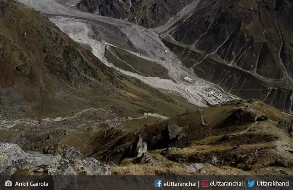
Trekking route: Gaurikund – Rambara – Garur Chatti – Kedarnath – Vasuki Tal - Painya Tal
Trek 3 kms ahead of Vasuki Tal, you’ll come across Painya Tal
, an undiscovered lake lying peacefully at an altitude of 4,400 mts. Painya Tal lies close to Mayali Pass. Reaching here requires you to traverse through steep cliffs which are quite exhausting. The lake, however, takes away all your exhaustion with its serene raw beauty.
3. Gandhi Sarovar
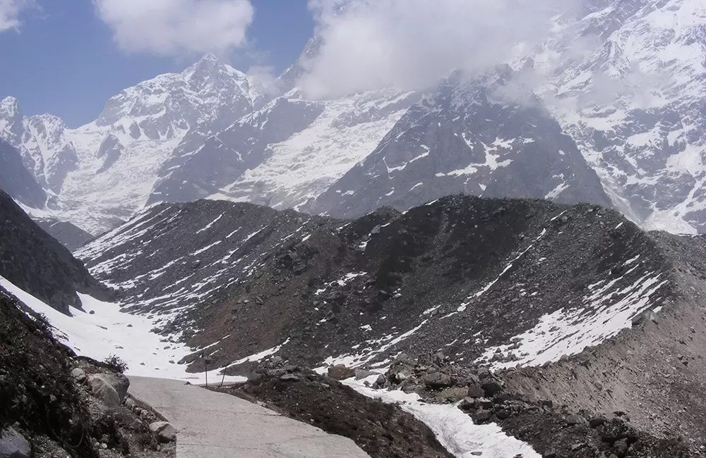
Trekking route: Gaurikund – Kedarnath – Gandhi Sarovar
Situated at the mouth of Chorabari Bamak glacier, Gandhi Sarovar is a small crystal clear lake, also known as Chorabari Tal. Gandhi Sarovar lies at the foot of Kedarnath and Kirthi Stambh peak at an elevation of 3,900mts.
Gandhi Sarovar trek is just a 4 kms trek from Kedarnath and a total of 18kms trek from Gaurikund.
4. Panwali Kantha
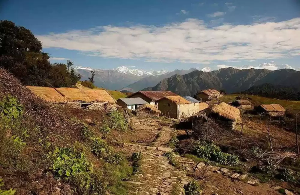
Trekking route: Guttu – Gaurmanda – Panwali Kantha
Panwali Kantha trek is one of those treks that you wouldn’t want to miss out on. Situated at an elevation of 3,500mts, the meadows of Panwali Kantha offers you the rare view of the complete range of Yamunotri, Gangotri, Kedarnath, and Badrinath mountain peaks and a wide variety of flowering herbs and animals.
The trek takes you through the seven bugyals/meadows of Panwali Kantha. The lush green meadows are a treat to the eyes in the summers while the same meadows covered in snow during winters look breathtaking.
Panwali Kantha is just 27kms from Kedarnath. The trekking begins from Guttu and after a trek of 18kms amidst a captivating landscape, you reach Panwali Kantha.
Treks around Badrinath
Treks Around Badrinath — Difficulty & Duration
| Treks | Difficulty | Approx Duration | Best Time |
|---|---|---|---|
| Vasudhara Falls | Easy to Moderate | 1 Day | May–Oct |
| Satopanth Lake | Moderate to Difficult | 4–5 Days | Jun–Sep |
| Alkapuri Glacier | Moderate to Difficult | 3–4 Days | Jun–Sep |
| Valley of Flowers | Easy to Moderate | 4–6 Days | Jul–Aug |
| Hemkund Sahib | Moderate | 2–3 Days | Jun–Sep |
1. Vasudhara Falls
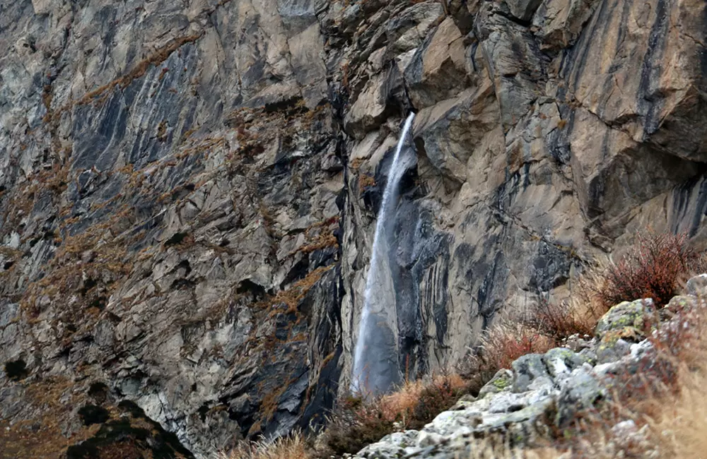
Trekking route: Mana village – Saraswati temple – Vasudhara Falls
Situated just 6kms from Badrinath, Vasudhara Falls is a ravishing waterfall plunging from a height of 122mts and set at an elevation of 3,658mts. The 5kms trek starts from Mana village and goes through Saraswati temple. From Vasudhara Falls, you’ll be able to see the stunning views of Chaukhamba, Neelkantha, and Balakun's peak, also known as Alakapuri.
2. Satopanth Lake trek
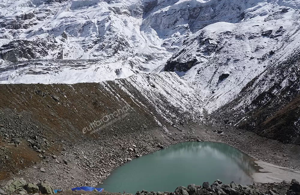
Trekking route: Mana – Chakratirtha – Satopanth Lake
The Satopanth Lake Trek is a high-altitude Himalayan adventure that leads to the sacred triangular-shaped Satopanth Lake, situated at an elevation of about 4,600 meters. The trek starts from Mana Village near Badrinath and passes through rugged mountain terrain, glacial landscapes, and scenic campsites.
- Trek Distance: Approximately 22 km from Mana Village.
- Difficulty Level: Moderate to Difficult.
- Duration: 3–4 days.
- Best Time to Visit: May to June and September to October.
- Guide Requirement: Hiring a local guide is highly recommended.
Trekkers pass through steep ascents, high-altitude conditions, and sections involving glacier crossings, making the trek physically demanding. The journey offers spectacular views of Chaukhamba, Neelkanth, and other Himalayan peaks, while the pristine Satopanth Lake remains the highlight of this unforgettable adventure.
3. Alkapuri glacier
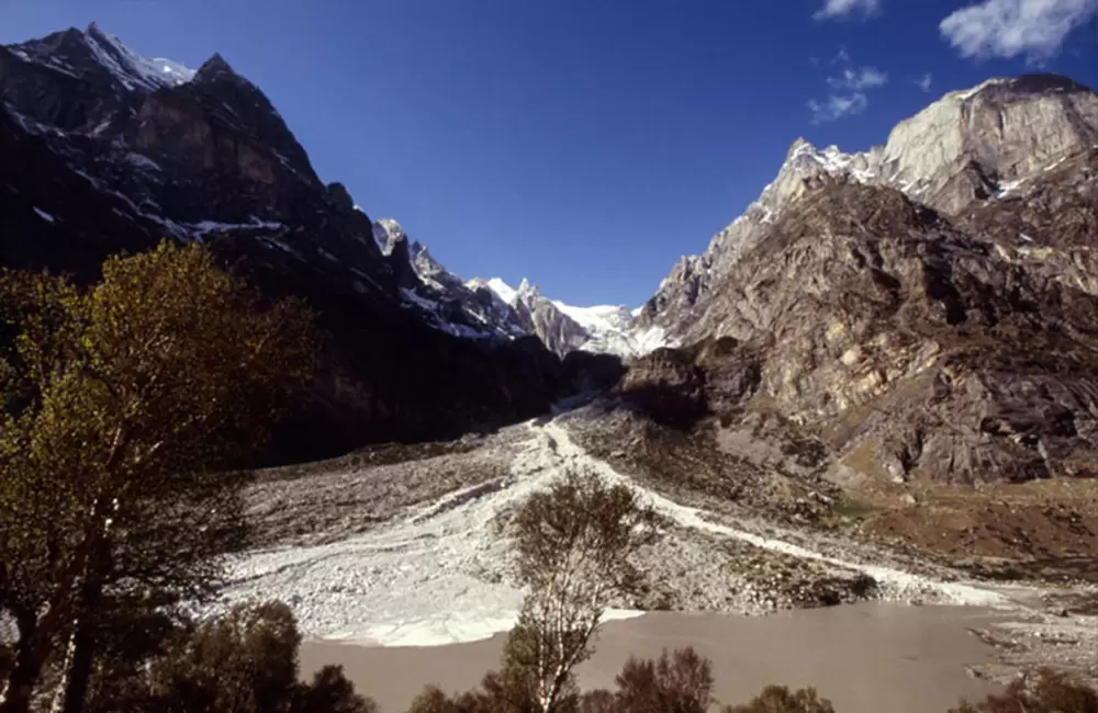
Trekking route: Mana village – Alkapuri Glacier
Alkapuri glacier is an enormous glacier situated at the base of Balakun peak at an elevation of 4,600mts. The glacier is the source of the Alaknanda River and spreads into two valleys leading to Satopanth and Gaumukh. Alkapuri Glacier trek is suitable for anyone who loves mountains and traversing through a Himalayan crevasse.
The glacier lies out 15kms from Badrinath and a 12kms trek from Mana village takes you to this magnificent place.
4. Valley of Flowers
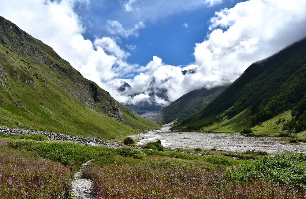
Trekking route: Govindghat – Ghangaria – Valley of Flowers
The Valley of Flowers Trek is one of the most popular treks in Uttarakhand and a visit to the famous UNESCO World Heritage Site, the Valley of Flowers. Known for its vibrant alpine meadows, rare Himalayan flora and diverse fauna, waterfalls, and stunning mountain views, this trek attracts nature lovers from across the world.
- Trek Distance: 13 km from Govindghat to Ghangaria and 4 km from Ghangaria to Valley of Flowers.
- Difficulty Level: Easy to Moderate.
- Duration: 2–3 days.
- Best Time to Visit: July to September, when the valley is in full bloom.
- Permit: Entry permit required at the Valley of Flowers National Park gate.
The trek offers breathtaking scenery, rich biodiversity, and a chance to witness one of the most beautiful flower-filled landscapes in the Himalayas.
5. Hemkund Sahib
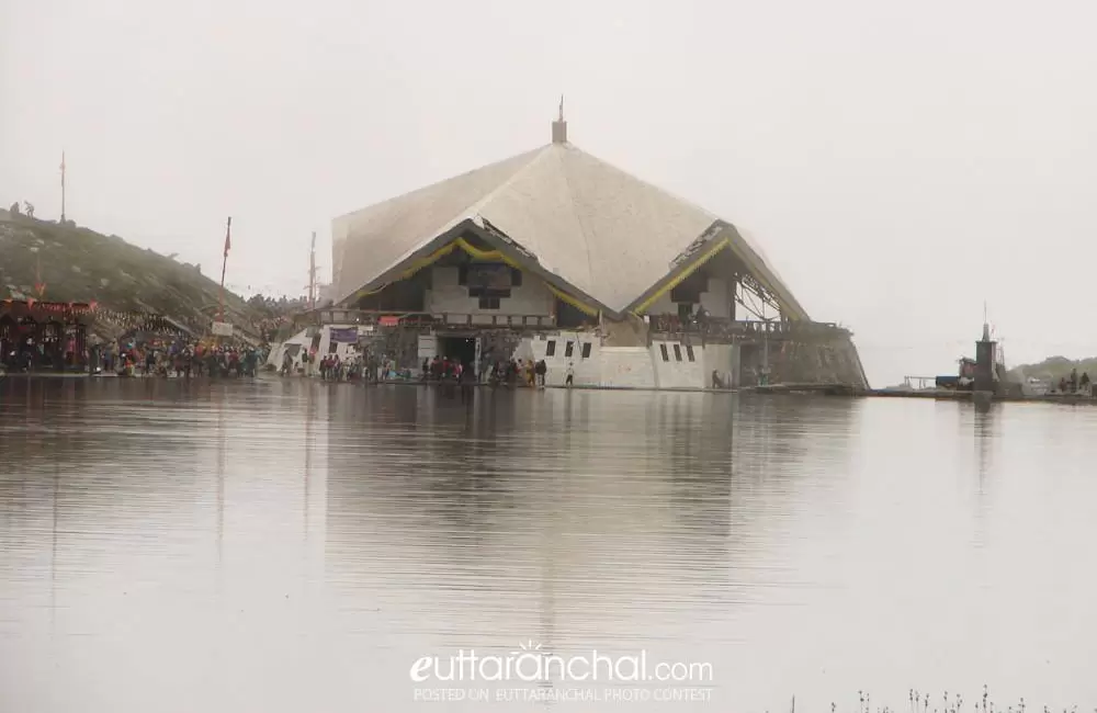
Trekking route: Govindghat – Ghangaria – Hemkund Sahib
The Hemkund Sahib is a sacred pilgrimage and one of the most challenging treks in Uttarakhand. Situated at an altitude of 4,632 meters, Hemkund Sahib is a sacred Sikh shrine set beside a glacial lake and surrounded by snow-clad Himalayan peaks.
- Trek Distance: 19 km from Govindghat to Ghangaria and Hemkund Sahib (one way).
- Difficulty Level: Moderate to Difficult.
- Duration: 1–2 days from Ghangaria.
- Altitude Gain: Around 1,100 meters from Ghangaria to Hemkund Sahib.
- Best Time to Visit: June to September.
The final 6 km stretch from Ghangaria involves a steep ascent with stone-paved pathways and numerous zigzag trails. Trekkers can witness breathtaking views of the pristine Hemkund Lake, dramatic mountain scenery, and a deeply spiritual atmosphere at one of the highest gurudwaras in the world.
Treks on the route of Kedarnath and Badrinath
Treks on Route of Kedarnath & Badrinath — Difficulty & Duration
| Treks | Difficulty | Approx Duration | Best Time |
|---|---|---|---|
| Chopta – Tungnath – Chandrashila | Easy to Moderate | 1–2 Days | Year Round (except heavy snow) |
| Deoria Tal | Easy | 1 Day | Year Round |
1. Chopta- Tunganath- Chandrashila Trek
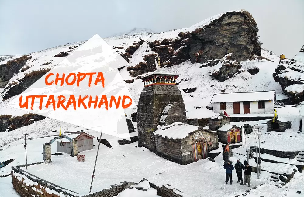
Trekking route: Chopta – Tunganath – Chandrashila
Tunganath temple, dedicated to Lord Shiva is one of the sacred Panch Kedars. Situated at an elevation of 3,680mts, Tunganath Temple is the highest temple of Lord Shiva. The temple stands tall at Chandranath Parvat.
Ahead of Tungnath, at a short gradient of 1.5 kms lies Chandrashila peak, standing tall at an elevation of 4,000mts.
The Chandrashila Tunganath Trek is one of the most popular treks of Uttarakhand. The picturesque trail of the trek and the exhilarating view of the snow-capped mountains with peaks like Kedarnath Dome, Chaukhamba, Trishul, and Nanda Devi surrounding you, all lead to an extraordinary experience.
The base camp for Chandrashila Tunganath Trek is Chopta, a beautiful scenic hamlet with its own charm.
2. Deoria Tal
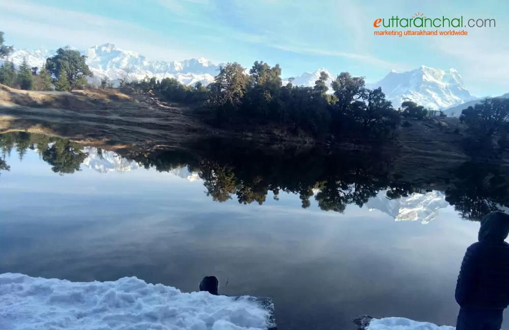
Trekking route: Sari village – Deoria Tal
The emerald lake situated at an elevation 2,438mts provides you an experience of two worlds- one being the pristine beauty of the flora, fauna, and the surrounding mountain peaks, and the other being the mesmerizing reflections of the surrounding in the crystal clear water of the lake, the most prominent one being of the Chaukhamba peak.
Since Deoria Tal falls under the Kedarnath Musk Deer Sanctuary, you will get to see animals strolling around the lake early in the morning.
Treks around Gangotri
Treks Around Gangotri — Difficulty & Duration
| Treks | Difficulty | Approx Duration | Best Time |
|---|---|---|---|
| Bhojbasa | Moderate | 2 Days | May–Oct |
| Gaumukh | Moderate | 2–3 Days | May–Oct |
| Tapovan | Difficult | 4–5 Days | May–Jun, Sep–Oct |
| Gangotri Glacier | Difficult | 5–6 Days | May–Jun, Sep–Oct |
| Kedartal | Difficult | 6–7 Days | May–Jun, Sep–Oct |
| Dodital & Darwa Pass | Moderate | 5–6 Days | Apr–Jun, Sep–Nov |
| Shivling Base Camp | Very Difficult | 7–8 Days | May–Jun, Sep–Oct |
| Sat Tal Harsil | Easy | 1 Day | May–Oct |
1. Bhojbasa Trek
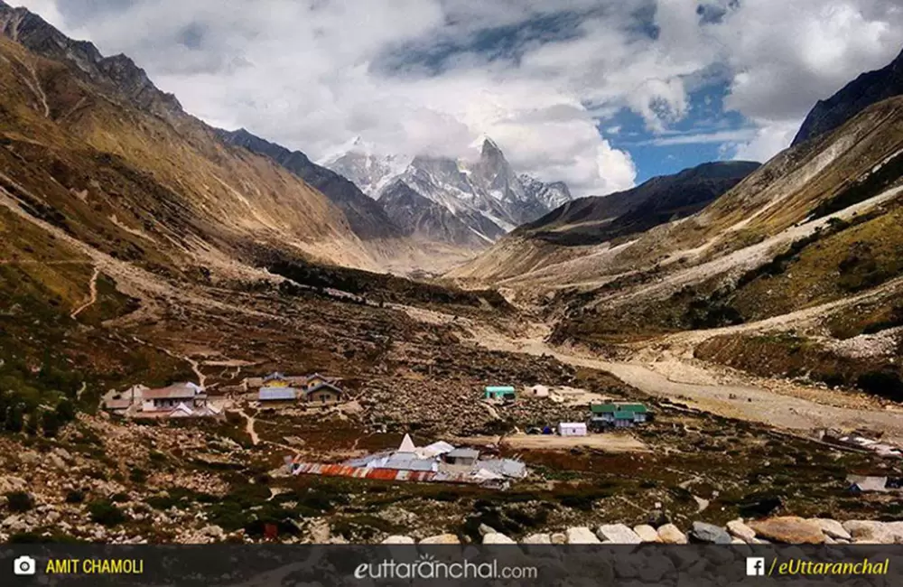
Trekking route: Gangotri – Bhojbasa
Bhojbasa is a picturesque location lying 14kms from Gangotri. The rugged terrains and the rough barren land alongside the Bhagirathi River give Bhojbasa a raw feel to it. Since Bhojpbasa is located on the way to Gaumukh Glacier, which lies 4 kms ahead of it, temporary accommodation facilities are plenty in Bhojbasa.
If you are feeling adventurous after visiting Gangotri and want to advance further, then Bhojbasa is the spot trek for you.
2. Gaumukh
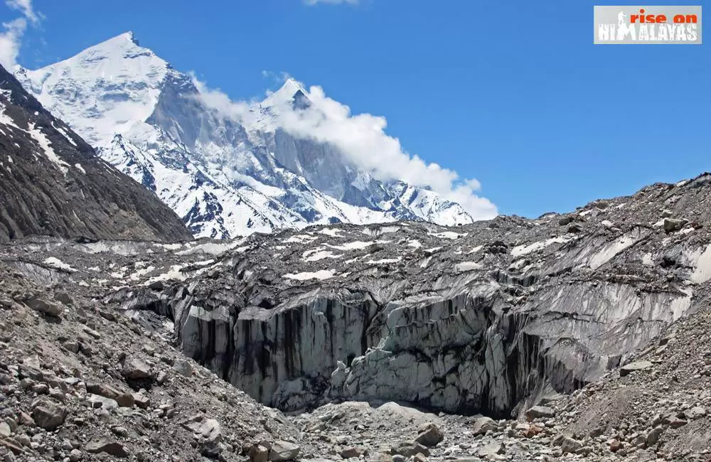
Trekking route: Gangotri – Bhojbasa – Gaumukh
Gaumukh is the snout of Gangotri Glacier and the source of the Bhagirathi River. The snout resembles the shape of a cow’s head and hence the name ‘Gaumukh’. Gaumukh is just 4kms from Bhojbasa and goes through rocky terrains. Mount Shivling looks exhilarating from Gaumukh.
3. Tapovan
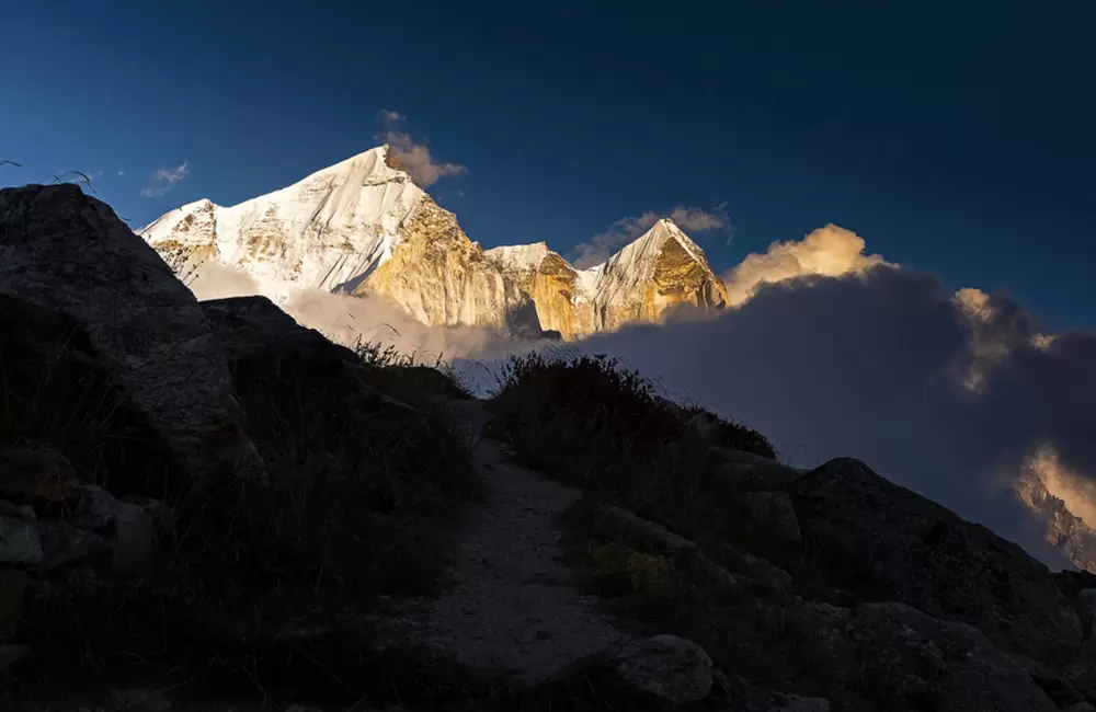
Trekking route: Gangotri – Bhojbasa – Gaumukh – Tapovan
Located at an elevation of 4,463mts, Tapovan is a famous trekking destination at the foot of the Shivling peak. Tapovan serves as the base camp for treks to Shivling peak, Bhagirathi peak, etc. The large meadows, gushing streams, and wild floras set amidst the majestic Himalayan peaks of Nanda Devi, Bhagirathi peak, etc.
Tapovan is located just 5kms from Gaumukh glacier.
4. Gangotri Glacier Trek
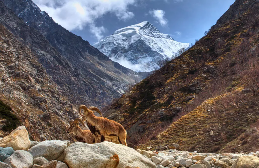
Trekking route: Gangotri – Bhojbasa – Gaumukh – Gangotri Glacier
The 30kms long and 4kms wide Gangotri glacier is one of the largest glaciers in the Himalayas and one of the primary sources of Ganges. Goumukh is the terminus of the Gangotri Glacier and the Goumukh-Gangotri trek is undertaken by many pilgrims who visit Gangotri temple and by adventure seekers who wish to trek to this magnificent glacier.
5. Kedartal
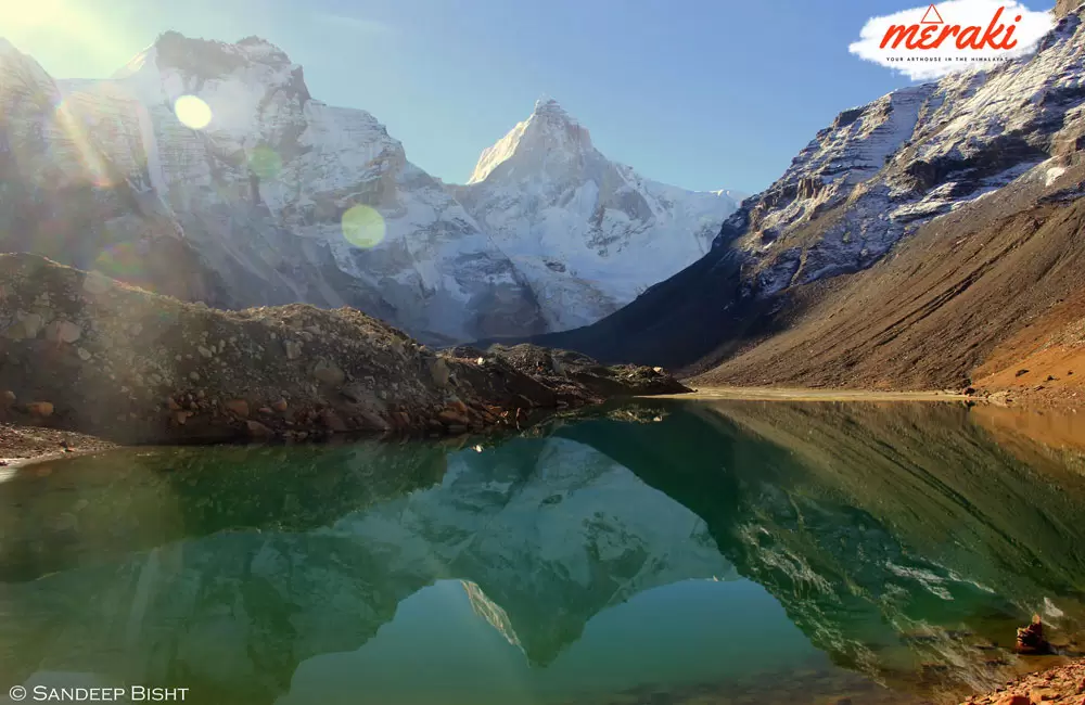
Trekking route: Gangotri – Bhojkharak – Kedar Kharak – Kedartal
Kedartal, which is also known as Shiva’s Lake is a glacial lake situated at an elevation of 4,750mts. The 18kms trek from Gangotri is an adventurous and a difficult one. From Kedartal, you’ll be able to see Mt. Gangotri, Mt. Thalaysagar, Mt. Bhrigupanth, and Mt. Jogin right in front of you.
The views from Kedartal and the view while trekking towards Kedartal is one of the best with mountain peaks, high altitude pastures, and magnificent pine forests accompanying you as you move further.
6. Dodital with Darwa Top/Pass Trek
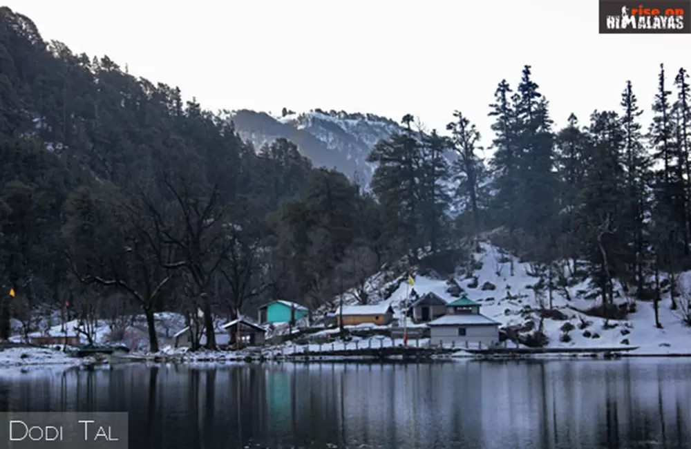
Trekking route: Sangam Chatti – Agoda – Bebra – Manjhi – Dodital – Darwa Top
The Dodital trek with Darwa Top is a scenic Himalayan trail known for its peaceful lake, dense forests, and high mountain views. The trek begins from Sangam Chatti near Uttarkashi and leads to the beautiful Dodital Lake before ascending further to Darwa Top.
Dodital, situated at around 3,010 meters, is an emerald freshwater lake surrounded by thick oak, pine, and deodar forests. The forest trail is rich in natural beauty, with peaceful campsites at Manjhi and Dodital offering ideal overnight stays.
A highlight of the trek is the trout-filled Dodital Lake, known for its calm waters and serene surroundings, making it a perfect camping spot for trekkers. From Dodital, a steep 10 km ascent leads to Darwa Top (4,150 meters), offering panoramic views of Himalayan peaks including the Banderpoonch massif.
- Trek Duration: 5–7 days
- Difficulty Level: Moderate
- Best Season: April–June and September–November
- Trail Highlights: Dense forests, alpine campsites, Dodital Lake, and high Himalayan viewpoints
This trek is ideal for those seeking a mix of forest trekking, peaceful lakeside camping, and rewarding summit views.
7. Shivling Base Camp Trek
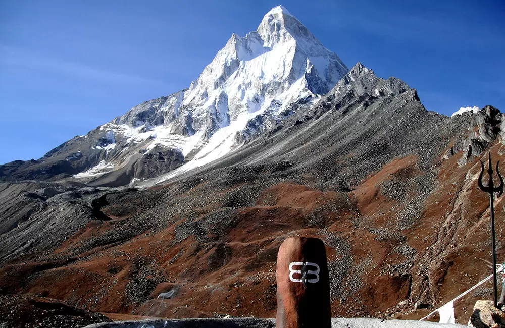
Trekking route: Gangotri – Bhojwassa – Gaumukh – Tapovan – Meru Glacier – Nandanvan – Vasuki Tal – Bhojwassa
Mount Shivling is one of the most sacred peaks of the Garhwal Himalayas soaring at an elevation of 6,543mts. It is a difficult trek which starts from Gangotri and goes through Gaumukh, Tapovan, Meru Glacier, Nandanvan, and Vasuki Tal, all of which offer spectacular views and a terrain worth exploring.
8. Sat Tal Harsil Trek
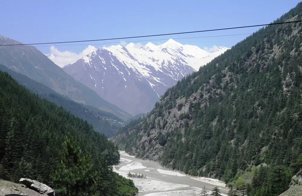
Trekking route: Harsil – Dharali village – Sat Tal
Sat Tal is a cluster of seven beautiful high altitude natural lakes located near the town of Harsil. Harsil is located just 25kms from Gangotri and the trek begins from Dharali village which is located about 2kms from Harsil. The 3 kms trek towards Sat Tal is an easy one which goes through a picturesque landscape.
All the lakes are close to each other and the view is refreshing to the soul.
Treks around Yamunotri
Treks Around Yamunotri — Difficulty & Duration
| Treks | Difficulty | Approx Duration | Best Time |
|---|---|---|---|
| Ruinsara Tal | Difficult | 6–7 Days | May–Jun, Sep–Oct |
1. Ruinsara Tal
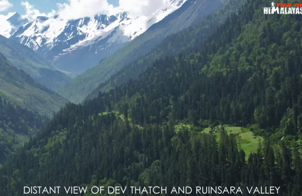
Trekking route: Sankri – Taluka – Osla – Har Ki Doon – Debshu Bugyal – Ruinsara Tal – Bali Pass – Yamunotri
Located at an elevation of 3,500mts at the foot of Mt.Kalanag, Ruinsara Tal is a clear water lake surrounded by wildflowers and alpine pastures. The trek to Ruinsara Tal passes through Har ki Dun Valley, famous for its scenic landscape, and Bali Pass, which is also known as Yamunotri pass. To the south-west of Ruinsara Tal, lies Yamuna Kanta, which is the pass leading to Yamunotri.
Bonus
Khatling Shahasratal Trek
Trekking route: Guttu – Reeh – Gangi – Kharsali – Bhedikharag – Khatling glacier
Khatling glacier is a lateral glacier perched at an elevation of about 4,000mts. The glacier is the source of Bhilangna River which is one of the major tributaries of Bhagirathi River. To the west of the glacier lies Sahastratal and to the east of the glacier lies Masartal and Vasuki Tal. The trek to Khatling glacier is a hard one suitable for adventure seekers with good fitness level.
Khatling glacier is 20kms from Kedarnath and 19kms from Gangotri.
Best Time for Trekking Around Char Dham
The Char Dham region of Uttarakhand offers some of the most scenic trekking routes in the Himalayas, but the experience varies greatly with seasons. Choosing the right time is important for safety, comfort, and clear mountain views.
May to June (Summer Season)
May to June is one of the best times for trekking in Uttarakhand. This is also the beginning of the Char Dham Yatra, when pilgrims visit the sacred shrines. The weather remains pleasant, snow starts melting, and most trekking routes become accessible. Forests are lush green, and higher-altitude trails like the Valley of Flowers begin to show early seasonal blooms.
July to August (Monsoon Season)
During monsoon season trekking is generally not recommended due to heavy rainfall, slippery trails, and risk of landslides. However, Valley of Flowers is at its peak bloom during this time, making it a special exception with caution.
September to October (Post-Monsoon Season)
September to October is also considered one of the best times for trekking. The skies are clear, views of Himalayan peaks are sharp, and the weather is stable. Trails are dry and perfect for longer treks like Dodital, Satopanth, and Vasuki Tal.
Flowering Season
The peak flowering period is from July to August, especially in the Valley of Flowers, when the entire valley turns into a colorful alpine carpet. Overall, May–June and September–October are the most recommended months for trekking around the Char Dham region.
Char Dham Yatra Guide
- Char Dham Packages
- Char Dham Hotels
- Char Dham Registration
- Char Dham Car Rentals
- Char Dham Route
- Char Dham Travel Tips
- Char Dham Yatra News
- Kedarnath Helicopter Services
- Char Dham Yatra by Helicopter
- Do Dham Same Day Helicopter Tour